Pages

Showing posts with label Nosing Around Maine. Show all posts

Saturday, September 8, 2012

Maine’s Fourth Annual Lighthouse Day


©Copyright Gail J. VanWart 2011, All rights Reserved

Sometimes referred to as North America’s castles, our lighthouses in the United States have, over the years, provided us with more than signals warning of impending danger along our coastlines. Each lighthouse serves as a little beacon of history and projects insights from the experiences of past “keepers” and their families we can learn from today. Much of our coastal history could have long been forgotten if it had not been recorded in a lighthouse keeper’s log.

© Copyright Gail J. VanWart 2011 All Rights ReservedIn Maine alone, more than sixty unique beacons of history dot the rocky Atlantic coastline, both on and off shore. Wherever you happen to be along the Maine coast, there will be a lighthouse somewhere nearby. If you want to take a closer look at one, inside and out, mark September 15th on your calendar. More than 15,000 people visited Maine’s twenty-four open light stations during their 2011 open lighthouse event, which proved to be the largest effort of its kind in the nation with 4,100 people climbing up into the towers to experience first hand a lighthouse keeper’s view. I’m very happy to say, in spite of my fear of heights,  I was one of them.

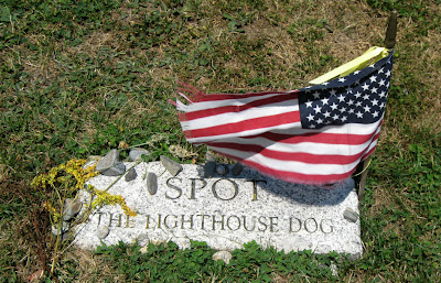
© Copyright Gail J. VanWart 2011 All Rights ReservedMy light of choice last year was Owl's Head, land based and southeast of Rockland (and pictured in this post). I’ve always enjoyed the pleasant walk in to the light and I adore the legends surrounding this station, especially tales of “Spot the Lighthouse Dog” whose final resting place is on the lighthouse grounds near the fog bell which brought him fame. And, I can’t help but love its legendary, and probably, downright, fibs. They, too, are charming in their own way and may contain a speck or two of truth. The biggest of such "fibs" I’ve heard is the tale of lighthouse keeper William Masters and his heroic rescue of Richard Ingraham and Lydia Dyerin in December of 1850. Both Ingraham and Dyerin were reportedly frozen alive into blocks of ice on the deck of their vessel during in a winter storm. Masters supposedly took them ashore and thawed them back to life in his kitchen. (If you believe that, I have a lighthouse for sale in Baxter State Park you can make an offer on.)
© Copyright Gail J. VanWart 2011 All Rights Reserved© Copyright Gail J. VanWart 2011 All Rights ReservedThe Owl’s Head light tower, itself, is an easy climb as it is only 30 feet tall. However, it stands on top of a rock formation nearly 70 feet in height that provides a 100-foot focal plane for the tower’s Fresnel lens. You’ll find interesting historic facts and trivia on display in a kiosk, thanks to former lighthouse keeper, David Bennett, who generously constructed it for the entrance to the grounds. You’ll also be pleased with the beautiful picnic area and ample parking.

Many other Maine mid-coast light stations will be participating in the Open Lighthouse event and I myself, plan to take in several for a full day of lighthouse activity.

© Copyright Gail J. VanWart 2011 All Rights Reserved


For more detailed information, maps, and tour guides for Maine’s Lighthouses and Open Lighthouse Day visit these links:


The U.S. Coast Guard, the State of Maine and the American Lighthouse Foundation will present the fourth annual Maine Open Lighthouse Day, September 15, 2012, rain or shine. Most of the lighthouses participating will be open 9 a.m. to 3 p.m.


© Copyright Gail J. VanWart 2011 All Rights Reserved
Blae hopes you'll pay your respects to Spot
while visiting Owl's Head Light.

© Copyright Gail J. VanWart 2011 All Rights Reserved
One story on display in the kiosk is how
Owl's Head got its name. 

Gail J. VanWart is a regular contributor to 
theSCENE, a publication of Courier Publications LLC in Rockland, Maine  https://www.facebook.com/theSCENE1

© Copyright 2012 Gail J. VanWart   All Rights Reserved

Sunday, April 29, 2012

Craig Brook, a National Treasure


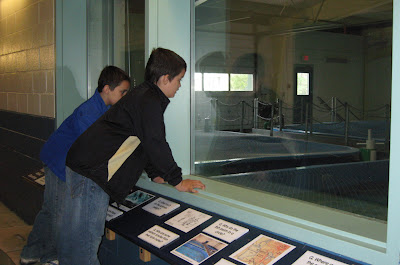
According to the U.S. Department of the Interior and U.S. Fish & Wildlife Service, when Atlantic salmon return to Maine’s rivers after feeding for two to three years at sea in the cold waters off Greenland, they will always return to their own native river where they hatched four years earlier. If an Atlantic salmon can survive all its predators, it can repeat the fresh water and ocean migration cycle and spawn, several times, during its life span. In spite of this, the Gulf of Maine’s distinct population of Atlantic salmon is an endangered species and the last remaining population of its kind in the United States. My grandsons and I learned all of that in a short time through well presented educational displays and interactive learning aids at the Craig Brook Fish Hatchery and Museum situated on Alamoosook Lake in East Orland, Maine.

The facility’s hatchery was established in 1871 as the first of its kind in the United States. Its purpose then, as today, is to propagate and stock juvenile Atlantic salmon to support their population. Over time, the facility has expanded to include archives and resource center, a museum, seminar site, an Atlantic salmon living stream, boat launches, picnic area, beautiful nature trails and a volunteer group called Friends of Craig Brook. There’s so much more you can learn by visiting the link at the bottom of this blog. Right now, I’d like to give you a tour of Craig Brook through the eyes of my grandsons during their recent visits to this quiet out of the way National treasure. 

© Copyright Gail J. VanWart  2011 All Rights Reserved
"The Leaper" welcomes guests to Craig Brook National Fish Hatchery.


© Copyright Gail J. VanWart 2011 All Rights Reserved

An interactive way to measure Altantic salmon survival rates.


© Copyright Gail J. VanWart  2011 All Rights Reserved 
Learning we can make a difference.
© Copyright Gail J. VanWart 2011 All Rights Reserved

Discovering what's in a watershed.


© Copyright Gail J. VanWart 2011 All Rights Reserved

Stages of growth and development of young Atlantic Salmon


© Copyright Gail J. VanWart 2012 All Rights Reserved

© Copyright Gail J. VanWart 2011 All Rights Reserved

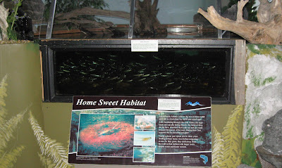
A healthy habitat is everything an Atlantic Salmon needs! 


© Copyright Gail J. VanWart 2012 All Rights Reserved

Adult Atlantic Salmon are housed in pens of water from their native rivers.


© Copyright Gail J. VanWart 2012 All Rights Reserved

Adult Atlantic Salmon 


© Copyright Gail J. VanWart 2011 All Rights Reserved

Artifacts from Ancient Fishermen at Alamoosook Lake

© Copyright Gail J. VanWart 2011 All Rights Reserved

There's lots to see and do at Craig Brook, inside and out.

© Copyright Gail J. VanWart 2011 All Rights Reserved

Fun and education for everyone!


Craig Brook National Fish Hatchery does not charge admission fees and group tours for schools and organizations can be arranged. However, donations are always welcome to assist in the operation, upkeep, and future expansion of the facilities.  Leashed pets with responsible owners are welcomed on the outside grounds. 


For more information: (207) 469-6701 x 215 or http://www.fws.gov/northeast/craigbrook/

© Copyright 2012 Gail J. VanWart All Rights Reserved


Tuesday, April 17, 2012

The Place of the Rocks

© Copyright 2012 Gail J. VanWart all Rights Reserved
Penobscot means "the place of the white shining rocks".


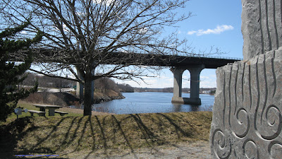
I can't tell you how many times I have passed by this place in the course of a routine day. It's the "place of the white shining rocks" situated conveniently by the on and off ramps of  I-395 on South Main Street in Brewer, Maine. At first glance, it seems like there are simply three huge rocks strategically placed in a rest area. A second glance will bring the realization there’s artwork carved on the front of the tallest center rock. But, as with most things, you really do have to take a minute to stop in order to appreciate everything you will never see just driving by. 

©Copyright 2012 Gail J. VanWart All Rights Reserved©Copyright 2012 Gail J. VanWart All Rights Reserved©Copyright 2012 Gail J. VanWart All Rights Reserved


A sign by the rocks, I had never read before, told me the story of why “the place of the rocks” exists. While discovering the artwork cleverly crafted on the other sides of the rocks not visible from the road, I also walked on bricks manufactured in Brewer a long time ago and artfully laid between the rocks in a pattern representing continuity. Since my husband’s grandfather, Bruce VanWart, had worked in a Brewer brickyard, I was touching a bit of family history at “the place of the rocks” as well. An old Bangor Daily News clipping (below) of an article by Lawrence Carroll Allin, published on October 21, 1987, tells the Brewer brick story extremely well. The reason we have the article today is because my mother-in-law spied Bruce VanWart in the1939 photo that accompanied it and she passed it on to my husband with an arrow pointing out his grandfather, a man he’d never met.


All in all, I decided this little rest area is a beautiful place on the Penobscot River bank to stop, whether you're traveling though the area or a local, like me, taking a moment to embrace the local scenery. I'm sure I'll stop here again to enjoy the tranquil beauty of the river and the pictorial story sculpted in the monumental Maine bluestone rocks of it's natural resources and haunting image of Penobscot Indian Princess Molly, all created by Carole Hanson and Andreas Von Huene to commemorate Brewer's Centennial in 1989.  

Beyond all else, it's simply a nice place to walk a dog and imagine what the river was like when the bricks, that lay there now, were made.

Nosing Around Maine  © Copyright 2012 Gail J. VanWart All Rights Reserved.


Monday, April 9, 2012

Bass Harbor Head: My Guiding Light


Bass Harbor Head Light 


© Copyright 2012  Gail J. VanWart All Rights Reserved
Bass Harbor Head Light Tower
Last year I revised a t-shirt design I had created in the 1990s of Bass Harbor Light. Several months after, I was amazed to discover Bass Harbor Head Light is going to be featured as the quarter in the United States Mint 2012 America the Beautiful Ouarters® Program. I couldn’t have planned the timing of things any better than this accident of fate. I took it as a sign to poke around Bass Harbor a little bit more and Blae was hungry for some salt air.
Photo © Copyright 2012 Gail J. VanWart All Rights Reserved
Blae at Seawall Park
SW Harbor, Maine

© Copyright 2012  Gail J. VanWart All Rights Reserved
Around 1860, when the Bass Harbor Head Light was fairly new, more people inhabited its surrounding islands and coastline and one in five Maine residents were mariners. Maine’s lighthouses were key to survival in many instances. In modern times, our U. S. lighthouses are sort of like castles in Europe, each stands tall with its own unique history and mystique that draws visitors from near and far, year after year. Maine’s lighthouses, in many cases, are still functioning and useful, as well.

Bass Harbor, Maine is on the southwestern portion of Mount Desert Island known as the “quite side”. Its lighthouse was erected in 1858 to mark the bar across the eastern entrance of Blue Hill Bay. In 1974 the light was automated by the U. S. Coastguard and is now a private residence with outside access to the light tower and a walking path leading you to an excellent view of its front side from the ledges below. That is if you are up to a steep and somewhat challenging climb over the rocky incline tangled with weathered tree roots clinging to the cliff. It is a beautiful, but rugged, trail.
© Copyright 2012  Gail J. VanWart All Rights Reserved 
© Copyright 2012  Gail J. VanWart All Rights ReservedBy car, you can reach this out-of-the-way destination via Route 3 in Ellsworth, turning right onto Route 198, then turning right again on Route 102. The lighthouse can also be observed from Maine State Ferries and other vessels operating out of Bass Harbor and Frenchboro.

© Copyright 2012  Gail J. VanWart All Rights ReservedJohn Thurston was the first keeper to light the beacon at Bass Harbor Head on September 1, 1858. Until the US Coast Guard automated the lighthouse in 1974, twenty-two “wickies” in all had taken a turn at keeping the steadfast light glowing by their manual efforts for 116 years. Some stayed less than a full year, others two or more. Joseph M. Gray served as a keeper there from 1921 to 1938. When I read that on a sign at the lighthouse, I thought to myself how he must have really loved his job in spite of fog horns and clanging bells on those numerous days without enough visibility for the beacon’s light to do its job for those in the water depending on its guidance. My next thought was a curiosity wondering if I could locate him in my Gray family tree, since my mother’s maiden name is also Gray. Thanks to Ancestry.com and my copy of Descendants of Joshua Gray compiled in 2005 by the Gray Reunion Committee and published by Downeast Graphics & Printing Inc., Ellsworth, Maine, I soon had my answer. This lighthouse keeper is my fourth cousin two times removed. Though I never had a chance to meet him, as his life ended before mine began, I did want to know more about him.  Back on the Internet through a link to Lighthouse Digest, I learned quite a bit. He was actually Captain Joseph M. Gray who spent a total of 40 years of lighthouse service at Crabtree Ledge, Mt. Desert Rock, Great Duck Island, Marshall Point, and Bass Harbor—after his six years of fishing off Grand Banks and before retiring to a small cottage in Tremont. A very nice newspaper article by Henry Buxton published in May 1938 and reprinted by Lighthouse Digest in 2005 about lighthouse keeper Capt. Joseph M. Gray tells a compelling tale and portrays a man I can certainly be proud to have among the branches of my family tree. Again, when fate leads you somewhere, its best to take advantage of the trip.  Seems my fascination with Maine’s lighthouses has not only inspired my creativity over the years, it has guided me to some family roots along the way.
© Copyright 2012  Gail J. VanWart All Rights Reserved
Side view of Bass Harbor Head Light 

A partnership between the U. S. Coast Guard, State of Maine and American Lighthouse Foundation intends to increase awareness of Maine’s maritime heritage and the rich history of its lighthouses and lighthouse keepers by offering visitors the opportunity to go inside many of Maine’s historic beacons on Open Lighthouse Day, which will take place on September 15 this year.

For more information about the 2012 Bass Harbor Quarter, my Bass Harbor QRtee™  
t-shirt, Maine’s lighthouse history and events, or the memories of Captain Joseph M. Gray, please check out the following links.


Sunday, March 25, 2012

Low's Bridge

Nosing Around Maine - Low's Bridge
Low's Bridge spans 182 years of history on the Piscataquis River.
Ice chunks flowed under it on March 22, 2012.
Photos by Gail J. VanWart

Maine’s Historic Wooden Covered Bridges; Nine Left, Guilford Claims One of Them


Guilford claims to be the Chickadee and Lilac Capital of Maine and is a town known for its efforts to promote its natural resources to create green economic opportunities, beautification and recreation. The town has been hosting a River Festival for more than half a decade and the community prides itself for the development of the Guilford Memorial River Walk that provides a place for community members and visitors to experience Bald Eagles, Osprey, Blue Heron and other natural wonders along the banks of the Piscataquis River.


Nosing Around Maine - Marker at Low's BridgeAs you travel through Guilford along Route 15 it is the Piscataquis River and a wooden covered bridge, which suddenly pops into view, that captures your attention. The Maine Department of Transportation has provided a picnic area and turnout so you can stop and appreciate the amazing structure and learn about its historic significance to the area. There is something about its presence that makes you hope it will remain long into the future, and, looking at its history, I get the feeling others have had that same hope over the past 182 years. Nosing Around Maine - Low's Bridge, Guilford, ME

In 1830, the original covered bridge was built at this location, adjacent to land once owned by an early Guilford settler named Robert Low, to provide an easy commerce route between the towns of Guilford and Sangerville, The Piscataquis River, which it spans, took the original structure down in a flood in 1832. It was rebuilt and again destroyed by floodwaters in1857. In that same year, it was reconstructed by Isaac Wharff, who hauled granite by oxen team from Guilford Mountain (over seven miles away) and Leonard Knowlton who used mathematical calculations and a patented Long-truss design to develop a sturdier bridge. The third bridge lasted for 130 years, but the river still proved to be stronger when it once again washed the bridge away in a flood on April 1, 1987. The bridge now standing in its place is a replica in appearance, but even studier to meet today’s building standards. It was designed and constructed off site then placed on the original stone-masonry abutments which were raised about three feet in hopes to avoid possible flood damage in the future. Only time will tell if it was worth the effort. Let’s hope it was.

At one time, more than 120 covered bridges graced waterways throughout the state of Maine, today, there are only nine left standing. In 1985 the Maine Department of Transportation was given the authority to maintain and preserve the states historic bridges. This included the remaining wooden covered bridges (Babbs Bridge, Hemlock Bridge, Low’s Bridge, Robyville Bridge, Watson’s Settlement Bridge, Bennett Bridge, Lovejoy Bridge, Porter Parsonsfield Bridge, and Sunday River Bridge), as well as, four other historic bridge structures (Bailey Island Bridge, Grist Mill Bridge, Sewall’s Bridge, and Wire Bridge).


© Copyright 2012 Gail J. VanWart
All Rights Reserved
If there is a place in Maine you'd like me and Blae to sniff out for you, just send us an e-mail to peakedmtfarm@me.com with "Nosing Around Maine" in the subject line, cause you can get the-ah from he-ah.